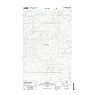
2016 Map of Eagle Mountain
USGS Topo · Published 2016About this map
Eagle Mtn stands as the prominent landmark within this portion of the Superior National Forest, marking a landscape defined by an intricate network of glacial lakes and portages. The Misquah Hills rise between deep water bodies like Winchell Lake to the north and the expansive Brule Lake to the south. This terrain preserves the traditional travel corridors of the North Woods, including the Brule Lake Trail and the Swan Lake-Vernon Lake portage route. The map illustrates a wilderness largely devoid of modern road infrastructure, focusing instead on the hydrographic connections between Vernon Lake, Swan Lake, and smaller named ponds such as Fishhook Lake and Redeye Lake. For researchers and outdoorsmen, it provides a detailed record of the elevations and shorelines within this protected Minnesota backcountry.
Find a feature on this map
61 named features on this map. Tap any name to fly to it.
Don’t see what you’re looking for? This feature index may not catch every label — zoom into the map to look around manually.
Map Details
Editions of this 2016 Eagle Mountain Map
This is the sole edition of this map. No revisions or reprints were ever made.
Other maps of this area

1919 · Brule Lake
USGS Topo · 1:62,500

1954 · Two Harbors
USGS Topo · 1:250,000

1957 · Two Harbors
USGS Topo · 1:250,000

1957 · Quetico
USGS Topo · 1:250,000

1958 · Two Harbors
USGS Topo · 1:250,000

1959 · Lima Mountain
USGS Topo · 1:24,000

1959 · Hungry Jack Lake
USGS Topo · 1:24,000

1960 · Tait Lake
USGS Topo · 1:24,000
1960 · Devil Track Lake
USGS Topo · 1:24,000

1960 · Mark Lake
USGS Topo · 1:24,000