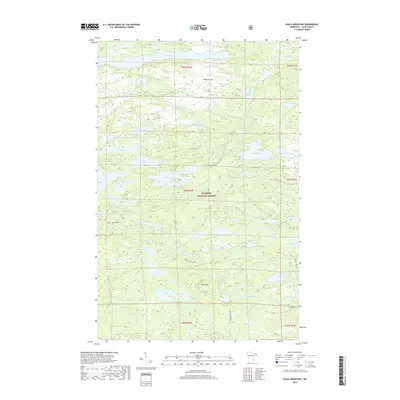
2019 Map of Eagle Mountain
USGS Topo · Published 2019About this map
Eagle Mtn stands as the central landmark of this terrain, located within the expansive Superior National Forest. The landscape is dominated by a dense network of glaciated water bodies, including the sprawling Winchell Lake to the north and the complex shoreline of Brule Lake with its prominent Brule Bay. These lakes are connected by a system of traditional routes such as the Swan Lake-Vernon Lake passage, reflecting the long-standing water-and-trail transit patterns of the Minnesota wilderness.
Find a feature on this map
54 named features on this map. Tap any name to fly to it.
Don’t see what you’re looking for? This feature index may not catch every label — zoom into the map to look around manually.
Map Details
Editions of this 2019 Eagle Mountain Map
This is the sole edition of this map. No revisions or reprints were ever made.
Other maps of this area

1919 · Brule Lake
USGS Topo · 1:62,500

1954 · Two Harbors
USGS Topo · 1:250,000

1957 · Two Harbors
USGS Topo · 1:250,000

1957 · Quetico
USGS Topo · 1:250,000

1958 · Two Harbors
USGS Topo · 1:250,000

1959 · Lima Mountain
USGS Topo · 1:24,000

1959 · Hungry Jack Lake
USGS Topo · 1:24,000

1960 · Tait Lake
USGS Topo · 1:24,000
1960 · Devil Track Lake
USGS Topo · 1:24,000

1960 · Mark Lake
USGS Topo · 1:24,000