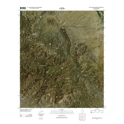
2012 Map of Eagle Mountains NE
USGS Topo · Published 2012About this map
Eagle Mountain Ranch serves as a primary point of habitation in this high-desert landscape within the Eagle Mountains. This 2012 survey illustrates a terrain defined by sparse water sources and essential ranching infrastructure, such as the Red Bluff Windmill and scattered seasonal outlets like Eagle Spring and Cypress Spring. The geography is dominated by significant elevations, including Eagle Peak and Panther Peak, which overlook a network of deep drainage features such as Carpenter Canyon and Cypress Canyon. Transportation through this isolated portion of Hudspeth County relies on a series of specialized routes, including Mine Rd and Guest Ranch Rd, reflecting the area's history of mineral exploration and livestock management. These named roads and water points trace the necessary adaptations for survival and industry in a territory where reliable water and accessible passes dictate the movement of people and livestock.
Find a feature on this map
18 named features on this map. Tap any name to fly to it.
Don’t see what you’re looking for? This feature index may not catch every label — zoom into the map to look around manually.
Map Details
Editions of this 2012 Eagle Mountains NE Map
This is the sole edition of this map. No revisions or reprints were ever made.
Other maps of this area

1892 · Chispa
USGS Topo · 1:125,000

1895 · Chispa
USGS Topo · 1:125,000

1895 · Sierra Blanca
USGS Topo · 1:125,000

1897 · Eagle Mountain
USGS Topo · 1:125,000

1897 · Chispa
USGS Topo · 1:125,000

1906 · Van Horn
USGS Topo · 1:125,000

1916 · Eagle Mountain
USGS Topo · 1:125,000

1954 · Van Horn
USGS Topo · 1:250,000

1958 · Van Horn
USGS Topo · 1:250,000

1959 · Marfa
USGS Topo · 1:250,000