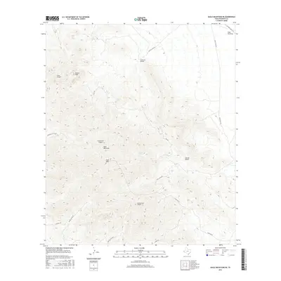
2016 Map of Eagle Mountains NE
USGS Topo · Published 2016About this map
Eagle Mountains dominate this high-altitude Hudspeth County landscape, anchored by the prominent summits of Eagle Peak and Panther Peak. This arid terrain is defined by a complex network of deep drainages, including Cottonwood Canyon, Frenchmans Canyon, and Goat Canyon, which cut through the mountain slopes. Water sources, vital for survival and settlement in the West Texas desert, are marked at Eagle Spring, Carpenter Spring, and Cypress Spring. A sparse network of unpaved roads and tracks provides the only access through the region, with the Southern Pacific Rd skirting the northern edges near Eagle Flat Draw. The presence of Mine Rd and various ranch-related routes like Guest Ranch Rd suggests a landscape utilized for mineral exploration and livestock grazing, where transportation is dictated by the steep contours of the surrounding peaks.
Find a feature on this map
21 named features on this map. Tap any name to fly to it.
Don’t see what you’re looking for? This feature index may not catch every label — zoom into the map to look around manually.
Map Details
Editions of this 2016 Eagle Mountains NE Map
This is the sole edition of this map. No revisions or reprints were ever made.
Other maps of this area

1892 · Chispa
USGS Topo · 1:125,000

1895 · Chispa
USGS Topo · 1:125,000

1895 · Sierra Blanca
USGS Topo · 1:125,000

1897 · Eagle Mountain
USGS Topo · 1:125,000

1897 · Chispa
USGS Topo · 1:125,000

1906 · Van Horn
USGS Topo · 1:125,000

1916 · Eagle Mountain
USGS Topo · 1:125,000

1954 · Van Horn
USGS Topo · 1:250,000

1958 · Van Horn
USGS Topo · 1:250,000

1959 · Marfa
USGS Topo · 1:250,000