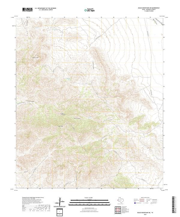
2022 Map of Eagle Mountains NE
USGS Topo · Published 2022About this map
Eagle Peak dominates this high-altitude landscape in West Texas, serving as a focal point within the broader Eagle Mountains range. This recent survey illustrates a terrain defined by deep drainages and isolated water sources, essential for survival in this arid environment. Key riparian markers such as Eagle Spring, Carpenter Spring, and Cypress Spring are tucked into the mountain folds, suggesting the historical importance of these rare permanent water points for travelers and local wildlife.
Find a feature on this map
21 named features on this map. Tap any name to fly to it.
Don’t see what you’re looking for? This feature index may not catch every label — zoom into the map to look around manually.
Map Details
Editions of this 2022 Eagle Mountains NE Map
This is the sole edition of this map. No revisions or reprints were ever made.
Other maps of this area

1892 · Chispa
USGS Topo · 1:125,000

1895 · Chispa
USGS Topo · 1:125,000

1895 · Sierra Blanca
USGS Topo · 1:125,000

1897 · Eagle Mountain
USGS Topo · 1:125,000

1897 · Chispa
USGS Topo · 1:125,000

1906 · Van Horn
USGS Topo · 1:125,000

1916 · Eagle Mountain
USGS Topo · 1:125,000

1954 · Van Horn
USGS Topo · 1:250,000

1958 · Van Horn
USGS Topo · 1:250,000

1959 · Marfa
USGS Topo · 1:250,000