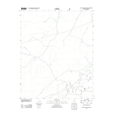
2012 Map of Eagle Nest Mountain
USGS Topo · Published 2012About this map
Goldtrap Ranch sits at the heart of this high-plateau landscape, where water management is the primary evidence of human industry. The network of drainage features like Partridge Cr and Monument Wash is punctuated by dozens of man-made catchment tanks, including Big Freeman Tank, Ship Dam Tank, and Limestone Tank. These scattered water sources represent the infrastructure required for cattle ranching in an arid environment, supporting operations connected by primitive routes such as Sevens Ranch Rd and Edwards Ranch Rd. The terrain is dominated by the prominent rise of Eagle Nest Mountain, providing a landmark for the network of Forest Service roads that lace the region. Local nomenclature like Phil McGill Tank and Big Bill Tank suggests a history of individual land use and family legacy tied to specific water rights across the Coconino county territory.
Find a feature on this map
30 named features on this map. Tap any name to fly to it.
Don’t see what you’re looking for? This feature index may not catch every label — zoom into the map to look around manually.
Map Details
Editions of this 2012 Eagle Nest Mountain Map
This is the sole edition of this map. No revisions or reprints were ever made.
Other maps of this area

1886 · Chino
USGS Topo · 1:250,000

1891 · Chino
USGS Topo · 1:250,000

1922 · Williams
USGS Topo · 1:125,000

1948 · Williams
USGS Topo · 1:250,000

1954 · Williams
USGS Topo · 1:250,000

1956 · Williams
USGS Topo · 1:250,000

1960 · Williams
USGS Topo · 1:250,000

1961 · Williams
USGS Topo · 1:250,000
1962 · Hearst Mtn.
USGS Topo · 1:62,500
1973 · Mount Floyd
USGS Topo · 1:24,000