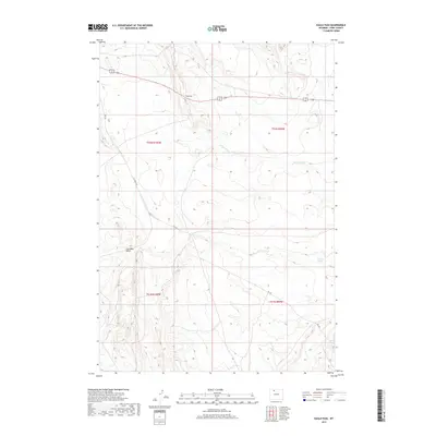
2017 Map of Eagle Pass
USGS Topo · Published 2017About this map
Eagle Pass serves as the namesake for this high-country landscape in Park County, where the topography is defined by the complex drainage systems of N Fork Dry Cr and Dry Cr. The map details a transition from the elevated pass down through steep terrain marked by the descriptive Coal Mine Gulch and Oregon Coulee. Human activity in the area is largely defined by the grid of the Public Land Survey System, with township boundaries for t52n r100w and t51n r100w carving the land into regular sections. A network of rural access roads, such as Yu Bench Rd, Rd 3fx, and Rd 3ju, provides the primary infrastructure through this isolated terrain, supporting livestock operations or mineral interests suggested by local place names.
Find a feature on this map
12 named features on this map. Tap any name to fly to it.
Don’t see what you’re looking for? This feature index may not catch every label — zoom into the map to look around manually.
Map Details
Editions of this 2017 Eagle Pass Map
This is the sole edition of this map. No revisions or reprints were ever made.
Other maps of this area

1911 · Oregon Basin
USGS Topo · 1:62,500

1913 · Oregon Basin
USGS Topo · 1:62,500

1951 · Y U Bench NW
USGS Topo · 1:24,000

1951 · Sheets Flat
USGS Topo · 1:24,000

1955 · Cody
USGS Topo · 1:250,000

1958 · Cody
USGS Topo · 1:250,000

1962 · Cody
USGS Topo · 1:250,000

1966 · Stone Barn Camp
USGS Topo · 1:24,000

1966 · Corbett Dam
USGS Topo · 1:24,000

1966 · Gilmore Hill
USGS Topo · 1:24,000