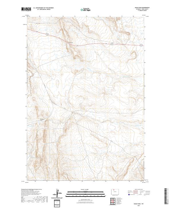
2021 Map of Eagle Pass
USGS Topo · Published 2021About this map
Eagle Pass and the surrounding high country of Park County define this landscape, where early water engineering and ranching heritage meet. The Wiley Canal cuts through the northern terrain, evidence of the vital role irrigation plays in this arid region, while Corbett Dam stands as a primary landmark of water management. The map reveals a history of land use ranging from the resource extraction suggested by Coal Mine Gulch to the seasonal operations at Stone Barn Camp. Large-scale ranching operations like the Y U Bench Ranch and Sleepers Ranch are situated among distinctive geological features, including the broad Oregon Basin and Sheets Flat. Navigating the area involves specialized local routes like Yu Bench Rd, which connects these remote outposts across a landscape of coulees and hills such as Gilmore Hill.
Find a feature on this map
21 named features on this map. Tap any name to fly to it.
Don’t see what you’re looking for? This feature index may not catch every label — zoom into the map to look around manually.
Map Details
Editions of this 2021 Eagle Pass Map
This is the sole edition of this map. No revisions or reprints were ever made.
Other maps of this area

1911 · Oregon Basin
USGS Topo · 1:62,500

1913 · Oregon Basin
USGS Topo · 1:62,500

1951 · Y U Bench NW
USGS Topo · 1:24,000

1951 · Sheets Flat
USGS Topo · 1:24,000

1955 · Cody
USGS Topo · 1:250,000

1958 · Cody
USGS Topo · 1:250,000

1962 · Cody
USGS Topo · 1:250,000

1966 · Stone Barn Camp
USGS Topo · 1:24,000

1966 · Corbett Dam
USGS Topo · 1:24,000

1966 · Gilmore Hill
USGS Topo · 1:24,000