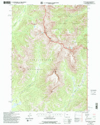
1991 Map of Eagle Pass
USGS Topo · Published 1996About this map
Yellowstone National Park meets the Shoshone National Forest at this high-altitude boundary revised by the Forest Service in the early 1990s. The terrain is defined by the Continental Divide and a series of massive summits, including Mount Schurz, Mount Humphreys, and the prominent Eagle Peak. This landscape is primarily accessed through historic backcountry routes like the Thorofare Trail and Mountain Trail, which follow the drainages of Beaverdam Creek and Howell Creek. The map documents a critical wilderness intersection within the Washakie Wilderness, showing the drainage patterns from Table Mountain and Turret Mountain that feed the region's remote river systems. The absence of modern roads highlights the area's role as a protected corridor for migration and conservation.
Find a feature on this map
17 named features on this map. Tap any name to fly to it.
Don’t see what you’re looking for? This feature index may not catch every label — zoom into the map to look around manually.
Map Details
Editions of this 1991 Eagle Pass Map
This is the sole edition of this map. No revisions or reprints were ever made.
Other maps of this area

1911 · Oregon Basin
USGS Topo · 1:62,500

1913 · Oregon Basin
USGS Topo · 1:62,500

1951 · Y U Bench NW
USGS Topo · 1:24,000

1951 · Sheets Flat
USGS Topo · 1:24,000

1955 · Cody
USGS Topo · 1:250,000

1958 · Cody
USGS Topo · 1:250,000

1962 · Cody
USGS Topo · 1:250,000

1966 · Stone Barn Camp
USGS Topo · 1:24,000

1966 · Corbett Dam
USGS Topo · 1:24,000

1966 · Gilmore Hill
USGS Topo · 1:24,000