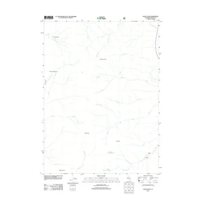
2012 Map of Eagle Peak
USGS Topo · Published 2012About this map
Eagle Peak and the surrounding high country of the Warner Mountains dominate this 2012 survey, where complex drainage systems define the high-altitude landscape. The map details the headwaters of numerous creeks, including Raider Cr, Highrock Cr, and Mill Cr, which carve through the terrain between prominent summits like Dusenbury Peak and Cole Peak. These waterways are central to the geography of the Modoc National Forest area, feeding into high-elevation features such as North Emerson Lake and South Emerson Lake.
Find a feature on this map
28 named features on this map. Tap any name to fly to it.
Don’t see what you’re looking for? This feature index may not catch every label — zoom into the map to look around manually.
Map Details
Editions of this 2012 Eagle Peak Map
This is the sole edition of this map. No revisions or reprints were ever made.
Other maps of this area

1886 · Alturas
USGS Topo · 1:250,000

1892 · Alturas
USGS Topo · 1:250,000

1954 · Alturas
USGS Topo · 1:250,000

1958 · Alturas
USGS Topo · 1:250,000

1962 · Alturas
USGS Topo · 1:250,000

1962 · Snake Lake
USGS Topo · 1:24,000

1962 · Jess Valley
USGS Topo · 1:24,000
1962 · Emerson Peak
USGS Topo · 1:24,000

1963 · Warren Peak
USGS Topo · 1:24,000
1963 · Hansen Island
USGS Topo · 1:24,000