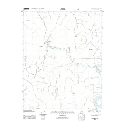
2012 Map of Eagle Rock
USGS Topo · Published 2012About this map
Roaring River Spring serves as a focal point for this Barry County landscape, feeding the Roaring River as it carves through deep hollows like Dry Hollow and Piber Hollow. The terrain is defined by dramatic limestone features, including a Natural Bridge and numerous ridge systems such as Walnut Ridge and Chute Ridge. Toward the east, the waters of Table Rock Lake reach into the valleys, meeting the mouth of the river near the settlement of Eagle Rock. Local history is preserved in landmarks such as the Munsey Cemetery and the legacy of the CCC Camp located along the riverbanks. The map also traces a network of forest roads and trails, such as Roaring River Rd and Falk Ridge Rd, which navigate the complex topography around Pelican Mountain and Wolfpen Gap.
Find a feature on this map
45 named features on this map. Tap any name to fly to it.
Don’t see what you’re looking for? This feature index may not catch every label — zoom into the map to look around manually.
Map Details
Editions of this 2012 Eagle Rock Map
This is the sole edition of this map. No revisions or reprints were ever made.
Other maps of this area

1900 · Eureka Springs
USGS Topo · 1:125,000

1901 · Eureka Springs
USGS Topo · 1:125,000

1927 · Shell Knob
USGS Topo · 1:62,500

1937 · Cassville
USGS Topo · 1:48,000

1944 · Cassville
USGS Topo · 1:62,500

1945 · Harrison
USGS Topo · 1:250,000

1949 · Harrison
USGS Topo · 1:250,000

1950 · Shell Knob
USGS Topo · 1:62,500

1954 · Harrison
USGS Topo · 1:250,000
1957 · Beaver
USGS Topo · 1:24,000