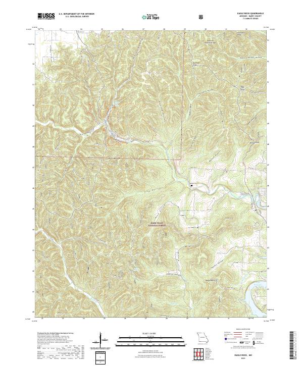
2021 Map of Eagle Rock
USGS Topo · Published 2021About this map
Mark Twain National Forest dominates this landscape in Barry County, where the topography is defined by a dense network of hollows and ridges. The Roaring River flows through the central section, fed by Roaring River Spring, creating a deeply incised drainage pattern that includes Ketchum Hollow and Piber Hollow. Geological interest is centered on features like the Cassville Natural Bridge and several springs, including Radium Spring, which hint at the region's complex karst environment.
Find a feature on this map
54 named features on this map. Tap any name to fly to it.
Don’t see what you’re looking for? This feature index may not catch every label — zoom into the map to look around manually.
Map Details
Editions of this 2021 Eagle Rock Map
This is the sole edition of this map. No revisions or reprints were ever made.
Other maps of this area

1900 · Eureka Springs
USGS Topo · 1:125,000

1901 · Eureka Springs
USGS Topo · 1:125,000

1927 · Shell Knob
USGS Topo · 1:62,500

1937 · Cassville
USGS Topo · 1:48,000

1944 · Cassville
USGS Topo · 1:62,500

1945 · Harrison
USGS Topo · 1:250,000

1949 · Harrison
USGS Topo · 1:250,000

1950 · Shell Knob
USGS Topo · 1:62,500

1954 · Harrison
USGS Topo · 1:250,000
1957 · Beaver
USGS Topo · 1:24,000