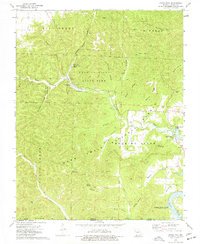
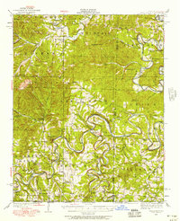
1974 Map of Eagle Rock
USGS Topo · Published 1977About this map
Roaring River State Park and the Mark Twain National Forest dominate this Barry County landscape, showing the Missouri Ozarks in the mid-1970s. The hydrology of the area is centered on the Roaring River and the emerging waters of Roaring River Spring, which supports a local Fish Hatchery. To the east, the impoundment of the White River is visible as Table Rock Lake, reaching an elevation of 915 feet. This era reflects a transition toward recreational land use, evidenced by numerous campgrounds, picnic areas, and Camp Opocoa.
Find a feature on this map
54 named features on this map. Tap any name to fly to it.
Don’t see what you’re looking for? This feature index may not catch every label — zoom into the map to look around manually.
Map Details
Editions of this 1974 Eagle Rock Map
This is the sole edition of this map. No revisions or reprints were ever made.
Other maps of this area

1900 · Eureka Springs
USGS Topo · 1:125,000

1901 · Eureka Springs
USGS Topo · 1:125,000
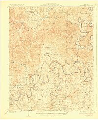
1927 · Shell Knob
USGS Topo · 1:62,500
1937 · Cassville
USGS Topo · 1:48,000
1944 · Cassville
USGS Topo · 1:62,500

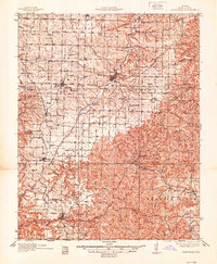
1945 · Harrison
USGS Topo · 1:250,000

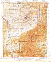
1949 · Harrison
USGS Topo · 1:250,000
1950 · Shell Knob
USGS Topo · 1:62,500

1954 · Harrison
USGS Topo · 1:250,000
1957 · Beaver
USGS Topo · 1:24,000