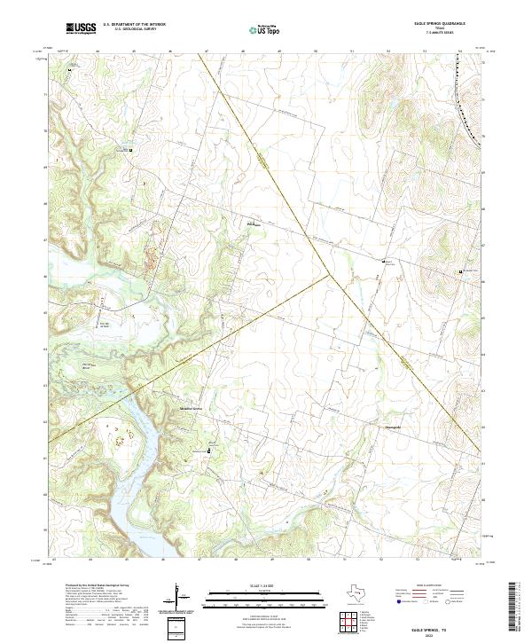
2022 Map of Eagle Springs
USGS Topo · Published 2022About this map
Eagle Springs and the surrounding rural landscapes of Bell, Coryell, and McLennan counties are defined by the winding course of the Leon River. The terrain transitions from upland plains into the deep, wooded breaks of Horseshoe Bend and the northern reaches of Belton Lake. Small, historic settlements like Whitson, Meador Grove, and Stampede anchor the road network, while numerous family and community burial grounds, including Eagle Springs Cem and Buckhorn Cem, provide significant points of interest for genealogical research. The geography here is characterized by several drainage systems, most notably Stampede Creek and Brewster Cr, which carve through the limestone-inflected topography of Central Texas. Landmarks such as the Tick Hill Airfield and the proximity of Mother Neff Pkwy suggest a landscape where agricultural life meets recreational and transit corridors.
Find a feature on this map
65 named features on this map. Tap any name to fly to it.
Don’t see what you’re looking for? This feature index may not catch every label — zoom into the map to look around manually.
Map Details
Editions of this 2022 Eagle Springs Map
This is the sole edition of this map. No revisions or reprints were ever made.
Other maps of this area

1892 · Temple
USGS Topo · 1:125,000

1894 · Gatesville
USGS Topo · 1:125,000

1924 · Gatesville 4-a
USGS Topo · 1:48,000

1924 · Temple 2-C
USGS Topo · 1:48,000

1924 · Temple 3-B
USGS Topo · 1:48,000

1930 · Killeen
USGS Topo · 1:62,500

1931 · Mc Gregor
USGS Topo · 1:62,500

1931 · Belton
USGS Topo · 1:62,500

1947 · Bland
USGS Topo · 1:24,000

1947 · Killeen
USGS Topo · 1:62,500