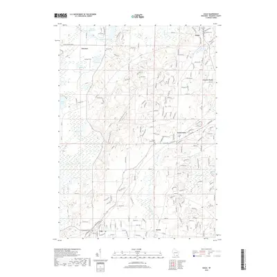
2018 Map of Eagle
USGS Topo · Published 2018About this map
Eagle and the surrounding glacial landscape of Waukesha County are defined by a complex network of wetlands and kettle lakes. The Ice Age National Scenic Trail meanders through the central corridor, tracing the moraine-heavy terrain south of Dousman. This 2018 survey reveals a rural area with deep historical roots, evidenced by numerous burial grounds such as Ottawa Cem and Jerusalem Cem that serve the outlying settlements of Wales, Genesee Depot, and North Prairie. The hydrologic character of the region is shaped by the Scuppernong River and Jericho Cr, which feed into various basins including Ottawa Lake and Spring Lake. These water systems, alongside Hunters Millpond 17, reflect a long-standing relationship between the local geography and the agricultural and residential development seen in the township grids and county roads.
Find a feature on this map
179 named features on this map. Tap any name to fly to it.
Don’t see what you’re looking for? This feature index may not catch every label — zoom into the map to look around manually.
Map Details
Editions of this 2018 Eagle Map
This is the sole edition of this map. No revisions or reprints were ever made.
Other maps of this area

1892 · Watertown
USGS Topo · 1:62,500

1892 · Oconomowoc
USGS Topo · 1:62,500

1892 · Whitewater
USGS Topo · 1:62,500

1892 · Eagle
USGS Topo · 1:62,500

1893 · Whitewater
USGS Topo · 1:62,500

1894 · Watertown
USGS Topo · 1:62,500

1894 · Eagle
USGS Topo · 1:62,500

1897 · Eagle
USGS Topo · 1:62,500

1903 · Whitewater
USGS Topo · 1:62,500

1906 · Eagle
USGS Topo · 1:62,500