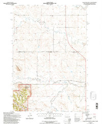
1993 Map of Eagles Nest Butte
USGS Topo · Published 1996About this map
Eagles Nest Butte stands as a prominent landmark in this northern high plains landscape, straddling the border between South Dakota and North Dakota. The map detail reflects a remote ranching and forest environment during the 1990s, where small rural infrastructure like the Lone Tree Sch and Cox Sch suggests the historic distribution of local education in the region. The Custer National Forest occupies the southwestern corner, featuring diverse terrain from Fuller Canyon and Fuller Pass to numerous named water sources such as Custer Spring and Cave Spring. Moving north, the North Fork Grand River and Crooked Creek define the drainage patterns of the area. Human activity is centered on sites like the Feist Ranch, a Scoria Pit, and the long-established Bullock Road connecting the scattered homesteads and resources of Harding County.
Find a feature on this map
27 named features on this map. Tap any name to fly to it.
Don’t see what you’re looking for? This feature index may not catch every label — zoom into the map to look around manually.
Map Details
Editions of this 1993 Eagles Nest Butte Map
This is the sole edition of this map. No revisions or reprints were ever made.
Other maps of this area

1935 · Reva
USGS Topo · 1:125,000

1935 · Buffalo
USGS Topo · 1:125,000

1953 · Dickinson
USGS Topo · 1:250,000

1954 · Lemmon
USGS Topo · 1:250,000

1957 · Dickinson
USGS Topo · 1:250,000

1957 · Lemmon
USGS Topo · 1:250,000

1968 · Bowman SW
USGS Topo · 1:24,000

1968 · Eagles Nest Butte
USGS Topo · 1:24,000

1968 · Ludlow
USGS Topo · 1:24,000

1968 · Tepee Buttes
USGS Topo · 1:24,000