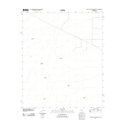
2011 Map of Eagletail Mountains East
USGS Topo · Published 2011About this map
The Eagletail Mountains define this high-desert landscape in Maricopa County, anchoring a terrain marked by prominent landmarks such as Courthouse Rock and Eagletail Peak. At the time of this 2011 survey, the area reflects a intersection of natural features and industrial infrastructure, where the El Paso Pipeline and the El Paso Natural Gas Company Ac Rd cut across the alluvial fans. In the lower elevations, water sources like Willow Spring provide rare points of interest amidst the stony slopes of Anvil Mountain and Granite Mountain. While the eastern edge shows the grid-like progression of roads like Indian School Rd and Centennial Rd, the western half remains dominated by the protected forms of the range, including the distinctive Eagletail Arch.
Find a feature on this map
15 named features on this map. Tap any name to fly to it.
Don’t see what you’re looking for? This feature index may not catch every label — zoom into the map to look around manually.
Map Details
Editions of this 2011 Eagletail Mountains East Map
This is the sole edition of this map. No revisions or reprints were ever made.
Other maps of this area

1942 · Vicksburg
USGS Topo · 1:250,000

1954 · Phoenix
USGS Topo · 1:250,000

1957 · Phoenix
USGS Topo · 1:250,000

1958 · Phoenix
USGS Topo · 1:250,000

1960 · Phoenix
USGS Topo · 1:250,000

1961 · Lone Mountain
USGS Topo · 1:62,500

1961 · Big Horn Mts
USGS Topo · 1:62,500

1962 · Cortez Peak
USGS Topo · 1:62,500

1962 · Eagletail Mts
USGS Topo · 1:62,500

1969 · Phoenix
USGS Topo · 1:250,000