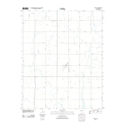
2012 Map of Eakly
USGS Topo · Published 2012About this map
Eakly serves as the central hub of this agricultural landscape in Caddo County, Oklahoma, structured around a rigid section-line road grid typical of the Great Plains. The town is defined by a modest network of local streets including Main St, Mauk Ave, and Clifford Ave, which coalesce near the local landmark of the Eakly Cem. Several watercourses, most notably Cobb Cr and Lake Cr, carve meandering paths across the geometric road network, creating small areas of uncultivated terrain in an otherwise heavily organized rural environment.
Find a feature on this map
29 named features on this map. Tap any name to fly to it.
Don’t see what you’re looking for? This feature index may not catch every label — zoom into the map to look around manually.
Map Details
Editions of this 2012 Eakly Map
This is the sole edition of this map. No revisions or reprints were ever made.
Other maps of this area

1951 · Binger
USGS Topo · 1:62,500

1951 · Fort Cobb
USGS Topo · 1:62,500

1955 · Clinton
USGS Topo · 1:250,000

1957 · Clinton
USGS Topo · 1:250,000

1961 · Eakly
USGS Topo · 1:62,500

1961 · Carnegie
USGS Topo · 1:62,500

1979 · Sickles
USGS Topo · 1:24,000
1979 · Fort Cobb Dam
USGS Topo · 1:24,000
1979 · Rock Mary
USGS Topo · 1:24,000

1984 · Eakly
USGS Topo · 1:24,000