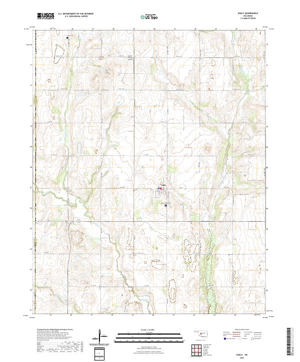
2022 Map of Eakly
USGS Topo · Published 2022About this map
Eakly sits at the center of this rural Oklahoma landscape, serving as a primary hub for the surrounding Caddo County agricultural region. The town is structured around a traditional grid featuring Main St and Church St, with the Eakly Cem located just to the south. The terrain is defined by the winding paths of several waterways, including Cobb Cr and Fivemile Cr, which have shaped the local topography into a series of drainage basins.
Find a feature on this map
39 named features on this map. Tap any name to fly to it.
Don’t see what you’re looking for? This feature index may not catch every label — zoom into the map to look around manually.
Map Details
Editions of this 2022 Eakly Map
This is the sole edition of this map. No revisions or reprints were ever made.
Other maps of this area

1951 · Binger
USGS Topo · 1:62,500

1951 · Fort Cobb
USGS Topo · 1:62,500

1955 · Clinton
USGS Topo · 1:250,000

1957 · Clinton
USGS Topo · 1:250,000

1961 · Eakly
USGS Topo · 1:62,500

1961 · Carnegie
USGS Topo · 1:62,500

1979 · Sickles
USGS Topo · 1:24,000
1979 · Fort Cobb Dam
USGS Topo · 1:24,000
1979 · Rock Mary
USGS Topo · 1:24,000

1984 · Eakly
USGS Topo · 1:24,000