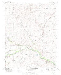
1970 Map of Earl
USGS Topo · Published 1974About this map
The Purgatoire River meanders through the southern half of this landscape, its path shadowed by the Atchison Topeka and Santa Fe railroad corridor. The settlement of Earl serves as a focal point along the rail line, representing the small-scale community hubs that defined this ranching and transport corridor in the early 1970s. The presence of multiple cemeteries, including Bloom Cem and Wilcox Cem, speaks to the generations of local families who established roots in the river valley.
Find a feature on this map
15 named features on this map. Tap any name to fly to it.
Don’t see what you’re looking for? This feature index may not catch every label — zoom into the map to look around manually.
Map Details
Editions of this 1970 Earl Map
2 editions found
Other maps of this area

1892 · Elmoro
USGS Topo · 1:125,000

1893 · Elmoro
USGS Topo · 1:125,000

1897 · Elmoro
USGS Topo · 1:125,000

1954 · Trinidad
USGS Topo · 1:250,000

1955 · Trinidad
USGS Topo · 1:250,000

1958 · Trinidad
USGS Topo · 1:250,000

1959 · Trinidad
USGS Topo · 1:250,000
1970 · Earl
USGS Topo · 1:24,000
1970 · Mooney Hills
USGS Topo · 1:24,000
1970 · Hoehne
USGS Topo · 1:24,000