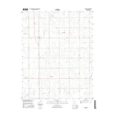
2015 Map of Earlton
USGS Topo · Published 2015About this map
Earlton and Urbana serve as the primary focal points of this Neosho County landscape, where the agricultural grid is defined by a dense network of numbered and named section roads. The Elk River meanders across the central portion of the survey, joined by tributaries such as Little Elk Cr and Turkey Cr. Local history is anchored by sites like the Urbana Cem and the naming of Earlton Cemetary Rd, providing specific points of interest for genealogical research in the region. To the north, the Veterans of Foreign Wars Lake stands out as a significant water feature amidst the prairie terrain. The infrastructure reflects a settled rural economy, with Arkansas St cutting through the heart of Earlton, while drainage patterns from Little Chetopa Cr shape the southern reaches of the quadrangle.
Find a feature on this map
34 named features on this map. Tap any name to fly to it.
Don’t see what you’re looking for? This feature index may not catch every label — zoom into the map to look around manually.
Map Details
Editions of this 2015 Earlton Map
This is the sole edition of this map. No revisions or reprints were ever made.
Other maps of this area

1886 · Fredonia
USGS Topo · 1:125,000

1886 · Iola
USGS Topo · 1:125,000

1886 · Independence
USGS Topo · 1:125,000

1886 · Parsons
USGS Topo · 1:125,000

1893 · Iola
USGS Topo · 1:125,000

1893 · Parsons
USGS Topo · 1:125,000

1894 · Fredonia
USGS Topo · 1:125,000

1894 · Independence
USGS Topo · 1:125,000

1904 · Iola
USGS Topo · 1:125,000

1905 · Independence
USGS Topo · 1:125,000