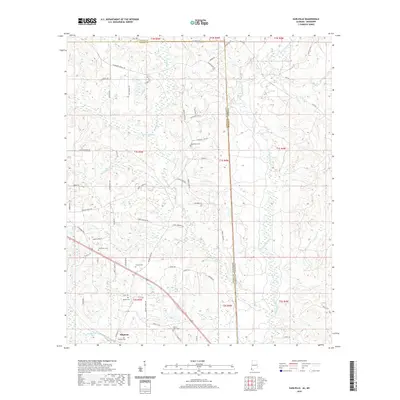
2020 Map of Earlville
USGS Topo · Published 2020About this map
The Escatawpa River carves a winding path along the state boundary, defining the border between Greene and George Counties in Mississippi and Mobile County in Alabama. This river system, joined by tributaries like Beaver Creek and Tennessee Cr, anchors a landscape defined by its riparian wetlands and low-lying drainages. In the southern reach, the settlement of Shipman serves as a local hub, accompanied by the nearby Shipman Cem. The map reveals a dispersed rural pattern of family-named roads and community anchors, such as Macedonia Cem and Mount Olive Cem, which reflect the area's genealogical history. The presence of several other burial grounds, including Oak Grove Cem and Moffet Cem, points to the long-established residential pockets scattered throughout the timberlands and creek bottoms of the Gulf Coastal Plain.
Find a feature on this map
72 named features on this map. Tap any name to fly to it.
Don’t see what you’re looking for? This feature index may not catch every label — zoom into the map to look around manually.
Map Details
Editions of this 2020 Earlville Map
This is the sole edition of this map. No revisions or reprints were ever made.
Other maps of this area

1941 · Lucedale
USGS Topo · 1:62,500

1942 · Deer Park
USGS Topo · 1:62,500

1942 · Wilmer
USGS Topo · 1:62,500

1943 · Lucedale
USGS Topo · 1:62,500

1943 · Deer Park
USGS Topo · 1:62,500

1944 · Wilmer
USGS Topo · 1:62,500

1953 · Hattiesburg
USGS Topo · 1:250,000

1953 · Mobile
USGS Topo · 1:250,000

1957 · Mobile
USGS Topo · 1:250,000

1958 · Hattiesburg
USGS Topo · 1:250,000