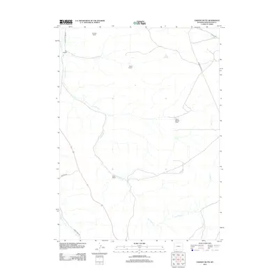
2012 Map of Earnest Butte
USGS Topo · Published 2012About this map
Earnest Butte stands as a prominent topographical landmark in this high-desert region of Sweetwater County, overseeing a landscape defined by an intricate network of seasonal drainages and springs. The area is dominated by the course of Little Bitter Cr, which winds through the western half of the map, joined by several named draws including Sally Little Bitter Cr Draw. This 2012 survey illustrates a terrain primarily managed for resource access and livestock, where reliable water sources like South Spring and Dry Canyon Spring dictate the local geography. The human footprint is most visible through a established network of ranching and mountain roads, such as Aspen Mountain Rd and Sage Creek Rd, which provide passage through the varied relief of Burnt Canyon and the surrounding basins.
Find a feature on this map
18 named features on this map. Tap any name to fly to it.
Don’t see what you’re looking for? This feature index may not catch every label — zoom into the map to look around manually.
Map Details
Editions of this 2012 Earnest Butte Map
This is the sole edition of this map. No revisions or reprints were ever made.
Other maps of this area

1954 · Rock Springs
USGS Topo · 1:250,000

1957 · Currant Creek Ranch
USGS Topo · 1:62,500

1957 · Firehole Basin
USGS Topo · 1:62,500

1958 · Rock Springs
USGS Topo · 1:250,000

1962 · Rock Springs
USGS Topo · 1:250,000
1963 · Maxon Ranch
USGS Topo · 1:24,000
1963 · Titsworth Gap
USGS Topo · 1:24,000

1966 · Firehole Basin
USGS Topo · 1:62,500

1966 · Currant Creek Ranch
USGS Topo · 1:62,500
1968 · South Baxter
USGS Topo · 1:24,000