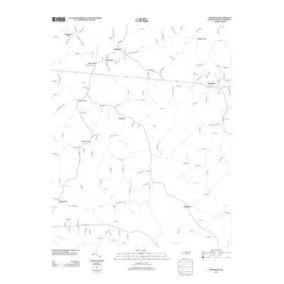
2013 Map of East Bend
USGS Topo · Published 2013About this map
East Bend and the surrounding rural communities of Yadkin County are captured in this topographic record, illustrating a landscape defined by small settlements and a dense network of creeks. The area is anchored by the historic legal and residential center at Richmond Hill and the community of Smithtown to the north, while smaller nodes like Poindexter, Forbush, and Baltimore are linked by a complex web of roads such as Siloam Rd and Martins Mill Rd.
Find a feature on this map
146 named features on this map. Tap any name to fly to it.
Don’t see what you’re looking for? This feature index may not catch every label — zoom into the map to look around manually.
Map Details
Editions of this 2013 East Bend Map
This is the sole edition of this map. No revisions or reprints were ever made.
Other maps of this area

1891 · Yadkinville
USGS Topo · 1:125,000

1893 · Yadkinville
USGS Topo · 1:125,000

1953 · Winston-Salem
USGS Topo · 1:250,000

1955 · Winston-Salem
USGS Topo · 1:250,000

1962 · Winston-Salem
USGS Topo · 1:250,000

1964 · Pinnacle
USGS Topo · 1:24,000
1966 · Farmington
USGS Topo · 1:24,000
1966 · Lone Hickory
USGS Topo · 1:24,000

1966 · Yadkinville
USGS Topo · 1:24,000

1966 · East Bend
USGS Topo · 1:24,000