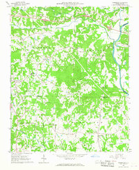
1966 Map of Farmington
USGS Topo · Published 1967About this map
The Yadkin River defines the eastern boundary of this Piedmont landscape, winding past the village of Huntsville and several early rural transportation routes. Historically significant thoroughfares like the Old Stage Road and Shallowford Road cross the terrain, linking scattered communities such as Shacktown, Courtney, and Farmington. The area is densely marked by local landmarks important to genealogy and community history, including Deep Creek Ch, Forbush Ch, and the Courtney High Sch.
Find a feature on this map
48 named features on this map. Tap any name to fly to it.
Don’t see what you’re looking for? This feature index may not catch every label — zoom into the map to look around manually.
Map Details
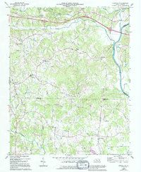
Editions of this 1966 Farmington Map
2 editions found
Other maps of this area

1891 · Yadkinville
USGS Topo · 1:125,000

1893 · Statesville
USGS Topo · 1:125,000

1893 · Yadkinville
USGS Topo · 1:125,000

1953 · Charlotte
USGS Topo · 1:250,000

1953 · Winston-Salem
USGS Topo · 1:250,000

1954 · Charlotte
USGS Topo · 1:250,000

1955 · Winston-Salem
USGS Topo · 1:250,000

1960 · Charlotte
USGS Topo · 1:250,000

1962 · Winston-Salem
USGS Topo · 1:250,000

1962 · Charlotte
USGS Topo · 1:250,000