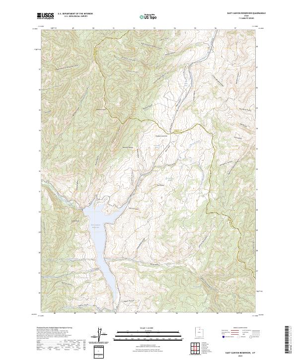
2023 Map of East Canyon Reservoir
USGS Topo · Published 2023About this map
East Canyon Reservoir dominates the drainage patterns of this high-elevation mountain terrain where Morgan and Summit Counties meet. The 2023 survey illustrates a landscape defined by deep drainages like Merdiths Canyon and The Gulch, and significant heights such as Redrock Peak and Rocky Ridge. Water sources are vital in this environment, marked by named points including Jack Beard Spring, Dixie Hollow Springs, and Tom Porter Springs.
Find a feature on this map
60 named features on this map. Tap any name to fly to it.
Don’t see what you’re looking for? This feature index may not catch every label — zoom into the map to look around manually.
Map Details
Editions of this 2023 East Canyon Reservoir Map
This is the sole edition of this map. No revisions or reprints were ever made.
Other maps of this area

1885 · Salt Lake
USGS Topo · 1:250,000

1900 · Coalville
USGS Topo · 1:125,000

1903 · Coalville
USGS Topo · 1:125,000

1925 · Ft. Douglas
USGS Topo · 1:125,000

1928 · Ft. Douglas
USGS Topo · 1:125,000

1954 · Salt Lake City
USGS Topo · 1:250,000

1954 · Ogden
USGS Topo · 1:250,000

1958 · Ogden
USGS Topo · 1:250,000

1958 · Salt Lake City
USGS Topo · 1:250,000

1960 · Ogden
USGS Topo · 1:250,000