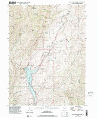
1997 Map of East Canyon Reservoir
USGS Topo · Published 2001About this map
East Canyon Reservoir dominates this landscape along the border of Morgan and Summit counties, its waters winding through steep canyons and deep hollows. The area is a significant corridor for western migration history, notably marked by the Mormon Pioneer No 1 and Donner-Reed Party Route, which traverses the terrain near Hogback Summit. This route passes through Dixie Hollow, where researchers can identify the Dixie Hollow Springs (Historic Campsite) and the Site of Dixie Hollow Pony Express Sta. This 1997 data shows the developed recreational area at East Canyon State Park alongside the high-elevation peaks and named springs that sustained travelers. Smaller landmarks like Grants Grave and numerous family-named springs such as Jack Beard Spring offer specific touchpoints for local genealogists studying the legacy of these mountain passes.
Find a feature on this map
62 named features on this map. Tap any name to fly to it.
Don’t see what you’re looking for? This feature index may not catch every label — zoom into the map to look around manually.
Map Details
Editions of this 1997 East Canyon Reservoir Map
This is the sole edition of this map. No revisions or reprints were ever made.
Other maps of this area

1885 · Salt Lake
USGS Topo · 1:250,000

1900 · Coalville
USGS Topo · 1:125,000

1903 · Coalville
USGS Topo · 1:125,000

1925 · Ft. Douglas
USGS Topo · 1:125,000

1928 · Ft. Douglas
USGS Topo · 1:125,000

1954 · Salt Lake City
USGS Topo · 1:250,000

1954 · Ogden
USGS Topo · 1:250,000

1958 · Ogden
USGS Topo · 1:250,000

1958 · Salt Lake City
USGS Topo · 1:250,000

1960 · Ogden
USGS Topo · 1:250,000