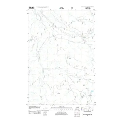
2011 Map of East Canyon Ridge
USGS Topo · Published 2011About this map
Cispus River and its numerous tributaries dominate this high-elevation landscape within the Gifford Pinchot National Forest region of Washington. The 2011 survey details a terrain defined by prominent crests and lookout points, including East Canyon Ridge, Table Mountain, and Summit Prairie. These heights were historically significant for fire surveillance, as evidenced by the Summit Prairie Lookout and Council Bluff Lookout. Recreational access is a primary feature of the modern era, with campsites like the Adams Fork Campground and Council Lake Campground positioned near the water. The drainage network is dense, with water bodies such as Mouse Lake and Council Lake feeding a complex system of creeks including Squaw Creek, East Canyon Creek, and Summit Prairie Creek. The map reflects the managed forest character of the Pacific Northwest, balancing natural topography with the infrastructure of forest roads and designated lookout stations.
Find a feature on this map
25 named features on this map. Tap any name to fly to it.
Don’t see what you’re looking for? This feature index may not catch every label — zoom into the map to look around manually.
Map Details
Editions of this 2011 East Canyon Ridge Map
This is the sole edition of this map. No revisions or reprints were ever made.
Other maps of this area

1926 · Steamboat Mtn
USGS Topo · 1:125,000

1931 · Steamboat Mtn
USGS Topo · 1:125,000

1950 · Yakima
USGS Topo · 1:250,000

1958 · Yakima
USGS Topo · 1:250,000

1961 · Yakima
USGS Topo · 1:250,000
1965 · Tower Rock
USGS Topo · 1:24,000
1965 · Quartz Creek Butte
USGS Topo · 1:24,000
1965 · Mc Coy Peak
USGS Topo · 1:24,000
1970 · Hamilton Buttes
USGS Topo · 1:24,000
1970 · Blue Lake
USGS Topo · 1:24,000