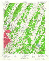
1965 Map of East Cleveland
USGS Topo · Published 1966About this map
Cleveland and its neighboring communities are shown during a period of significant growth and suburbanization in the mid-1960s. The urban core, indicated by a dense red tint, expands into North Cleveland and South Cleveland, while the path of Interstate 75 cuts through the western landscape. This era reflects a transition where traditional rural landmarks like Hays Mill and Rattlesnake Spring exist alongside modern infrastructure such as the Hardwick Airfield and the Bradley Co Nursing Home.
Find a feature on this map
80 named features on this map. Tap any name to fly to it.
Don’t see what you’re looking for? This feature index may not catch every label — zoom into the map to look around manually.
Map Details
Editions of this 1965 East Cleveland Map
This is the sole edition of this map. No revisions or reprints were ever made.
Other maps of this area

1886 · Cleveland
USGS Topo · 1:125,000

1892 · Cleveland
USGS Topo · 1:125,000

1895 · Cleveland
USGS Topo · 1:125,000

1901 · Cleveland
USGS Topo · 1:125,000

1935 · East Cleveland
USGS Topo · 1:24,000

1935 · Mc Donald
USGS Topo · 1:24,000

1935 · Calhoun
USGS Topo · 1:24,000

1935 · Benton
USGS Topo · 1:24,000

1935 · Felker
USGS Topo · 1:24,000

1935 · Charleston
USGS Topo · 1:24,000