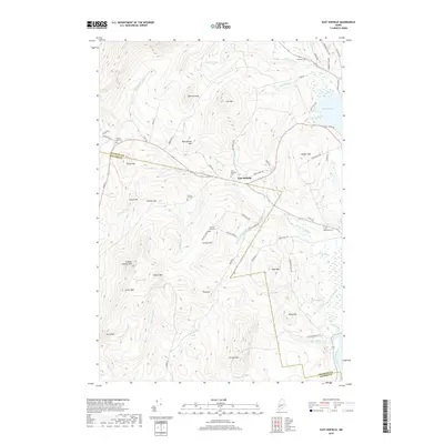
2018 Map of East Dixfield
USGS Topo · Published 2018About this map
East Dixfield sits as the primary settlement in this interior Maine landscape, positioned where Potash Brook meets the larger Sevenmile Stream. The terrain is defined by a series of prominent rises including Colonel Holman Mtn, Science Hill, and Canton Mtn, which overlook a network of smaller drainages like Dakin Brook and Gordon Brook. For those tracing local history, the map identifies several geographically dispersed burial grounds such as Intervale Cem, Tainter Corner Cem, and Severy Hill Cem, reflecting the early rural community structure. The far eastern edge of the area is anchored by the waters of Wilson Pond and the Androscoggin River. This modern survey reveals how local roads like Fenderson Hill Rd and Walker Hill Rd navigate the complex topography to connect these long-standing family-named peaks and settlements.
Find a feature on this map
75 named features on this map. Tap any name to fly to it.
Don’t see what you’re looking for? This feature index may not catch every label — zoom into the map to look around manually.
Map Details
Editions of this 2018 East Dixfield Map
This is the sole edition of this map. No revisions or reprints were ever made.
Other maps of this area

1910 · Livermore
USGS Topo · 1:62,500

1911 · Buckfield
USGS Topo · 1:62,500

1912 · Livermore
USGS Topo · 1:62,500

1913 · Buckfield
USGS Topo · 1:62,500

1924 · Farmington
USGS Topo · 1:62,500

1926 · Dixfield
USGS Topo · 1:62,500

1929 · Dixfield
USGS Topo · 1:62,500

1941 · Livermore
USGS Topo · 1:62,500

1942 · Buckfield
USGS Topo · 1:62,500

1950 · Lewiston
USGS Topo · 1:250,000