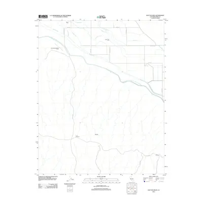
2012 Map of East Elk Hills
USGS Topo · Published 2012About this map
The Governor Edmund G Brown California Aqueduct dominates this landscape in western Kern County, carving a diagonal path between the agricultural plains and the rising terrain of the Elk Hills. This 2012 survey illustrates a complex water management system where the West Side Canal and East Side Canal intersect with a grid of smaller irrigation features like the Weed Island Ditch and Florida Drain. Industrial and agricultural operations are clearly marked, from the Mirasol Ranch and Poplar Grove Ranch in the north to the Three-G Gas Plant and Camp Thirty Six-R in the southern hills. The inclusion of the Elk Hills-Buttonwillow Airport and local thoroughfares such as Stockdale Hwy and Tupman Rd shows the infrastructure supporting the region's dual focus on petroleum extraction and intensive valley farming.
Find a feature on this map
29 named features on this map. Tap any name to fly to it.
Don’t see what you’re looking for? This feature index may not catch every label — zoom into the map to look around manually.
Map Details
Editions of this 2012 East Elk Hills Map
This is the sole edition of this map. No revisions or reprints were ever made.
Other maps of this area

1910 · Buena Vista Lake
USGS Topo · 1:125,000

1912 · McKittrick
USGS Topo · 1:125,000

1912 · Buena Vista Lake
USGS Topo · 1:125,000

1929 · Coles Levee
USGS Topo · 1:31,680

1929 · Mouth of Kern
USGS Topo · 1:31,680

1931 · Rio Bravo
USGS Topo · 1:31,680

1931 · Lokern
USGS Topo · 1:31,680

1932 · West Elk Hills
USGS Topo · 1:31,680

1932 · East Elk Hills
USGS Topo · 1:31,680

1932 · Mouth of Kern
USGS Topo · 1:31,680