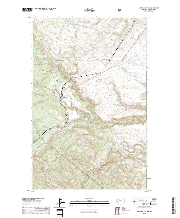
2024 Map of East Glacier Park
USGS Topo · Published 2024About this map
East Glacier Park Village serves as a primary gateway to the high country where the plains meet the mountains. This 2024 survey captures the convergence of significant water systems, including the Two Medicine River and the South Fork Two Medicine River, which carve through the landscape near Dawson Falls. The terrain is defined by the sharp transition between the Sawtooth Range and the surrounding national forest lands.
Find a feature on this map
35 named features on this map. Tap any name to fly to it.
Don’t see what you’re looking for? This feature index may not catch every label — zoom into the map to look around manually.
Map Details
Editions of this 2024 East Glacier Park Map
This is the sole edition of this map. No revisions or reprints were ever made.
Other maps of this area

1901 · Browning
USGS Topo · 1:125,000

1903 · Browning
USGS Topo · 1:125,000

1913 · Marias Pass
USGS Topo · 1:125,000

1960 · Cut Bank
USGS Topo · 1:250,000

1963 · Cut Bank
USGS Topo · 1:250,000

1964 · Cut Bank
USGS Topo · 1:250,000

1968 · Half Dome Crag
USGS Topo · 1:24,000
1968 · Kiowa
USGS Topo · 1:24,000
1968 · Browning
USGS Topo · 1:24,000
1968 · Starr School
USGS Topo · 1:24,000