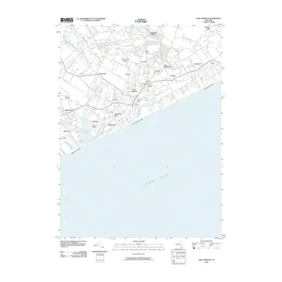
2010 Map of East Hampton
USGS Topo · Published 2010About this map
East Hampton and its surrounding villages occupy this stretch of the South Fork, where the coastal landscape is defined by its series of large coastal lagoons and ponds. The village core is densely detailed, featuring landmarks such as the Hook Windmill and the East Hampton Post Office. Cultural and genealogical history is well-preserved through a high concentration of burial grounds, including the North End Cemetery, South End Cemetery, and the Most Holy Trinity Roman Catholic Cemetery.
Find a feature on this map
55 named features on this map. Tap any name to fly to it.
Don’t see what you’re looking for? This feature index may not catch every label — zoom into the map to look around manually.
Map Details
Editions of this 2010 East Hampton Map
This is the sole edition of this map. No revisions or reprints were ever made.
Other maps of this area

1903 · Sag Harbor
USGS Topo · 1:62,500

1903 · Gardiners Island
USGS Topo · 1:62,500

1904 · Sag Harbor
USGS Topo · 1:62,500

1904 · Shelter Island
USGS Topo · 1:62,500

1904 · Easthampton
USGS Topo · 1:62,500

1904 · Gardiners Island
USGS Topo · 1:62,500

1921 · Gardiners Island
USGS Topo · 1:62,500

1921 · Easthampton
USGS Topo · 1:62,500

1943 · Gardiners Island East
USGS Topo · 1:24,000

1944 · Gardiners Island West
USGS Topo · 1:24,000
Featured Places
- Southampton, NY
- East Hampton, NY
- Springs, East Hampton
- East Hampton North, East Hampton
- Northwest Harbor, East Hampton