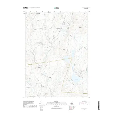
2018 Map of East Lempster
USGS Topo · Published 2018About this map
Lempster and East Lempster serve as the primary hubs in this high-elevation landscape where the Sullivan Co Cheshire Co boundary cuts through the hills. The terrain is defined by a series of prominent peaks and hollows, from Bean Mtn and Silver Mtn to the depths of Keyes Hollow and Dodge Hollow. This 2018 survey reveals a network of brooks and ponds feeding larger systems like the Ashuelot River, which flows through the eastern sector. Settlement patterns remain focused along historic corridors like the 2nd N H Tpke and Charlestown Tpke, connecting smaller nodes such as Marlow Junction and the site of Gee Mill. The presence of features like Russell Millpond and Barrett Pond suggests a long history of water management and local industry rooted in the area's complex hydrography, while family-named landmarks like Pollards Hill and Farnsworth Hill provide valuable points of reference for genealogists.
Find a feature on this map
114 named features on this map. Tap any name to fly to it.
Don’t see what you’re looking for? This feature index may not catch every label — zoom into the map to look around manually.
Map Details
Editions of this 2018 East Lempster Map
This is the sole edition of this map. No revisions or reprints were ever made.
Other maps of this area

1902 · Sunapee
USGS Topo · 1:62,500

1905 · Sunapee
USGS Topo · 1:62,500

1907 · Sunapee
USGS Topo · 1:62,500

1926 · Claremont
USGS Topo · 1:62,500

1927 · Bellows Falls
USGS Topo · 1:48,000

1929 · Claremont
USGS Topo · 1:62,500

1930 · Lovewell Mountain
USGS Topo · 1:62,500

1930 · Bellows Falls
USGS Topo · 1:62,500

1942 · Lovewell Mountain
USGS Topo · 1:62,500

1950 · Glens Falls
USGS Topo · 1:250,000