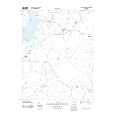
2011 Map of East New Market
USGS Topo · Published 2011About this map
Secretary and East New Market anchor this coastal Dorchester County landscape, where the Warwick River and Goose Creek feed into the broad Choptank River. The map documents a classic Eastern Shore layout of small crossroads settlements and water-oriented points, such as Secretarys Point and Oystershell Point. The transportation network is defined by traditional corridors like Linkwood Road and the Railroad Road, connecting interior hamlets like Hawkeye and Linkwood to the waterfront. Genealogy researchers will find several well-defined burial grounds, including Salem Cemetery and the Mount Pleasant Cemetery. The presence of the Higgins Millpond Dam on the Transquaking River highlights the historical importance of local water management and milling in this tidewater region, while riverside landmarks like Hughletts Landing recall the area's long-standing maritime character.
Find a feature on this map
90 named features on this map. Tap any name to fly to it.
Don’t see what you’re looking for? This feature index may not catch every label — zoom into the map to look around manually.
Map Details
Editions of this 2011 East New Market Map
This is the sole edition of this map. No revisions or reprints were ever made.
Other maps of this area

1898 · Choptank
USGS Topo · 1:125,000

1898 · St. Marys
USGS Topo · 1:125,000

1903 · Nanticoke
USGS Topo · 1:62,500

1904 · Oxford
USGS Topo · 1:62,500

1905 · Crapo
USGS Topo · 1:62,500

1905 · Hurlock
USGS Topo · 1:62,500

1906 · St. Marys
USGS Topo · 1:125,000

1908 · Choptank
USGS Topo · 1:125,000
1942 · Trappe
USGS Topo · 1:24,000

1942 · Mardela Springs
USGS Topo · 1:24,000