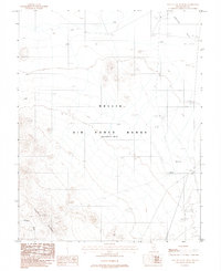
1987 Map of East of Cactus Peak
USGS Topo · Published 1988About this map
Nellis Air Force Range (Restricted Area) occupies the majority of this landscape in Nye County, showing a desert terrain adapted for military aviation training. The geography is defined by the transition from the rugged slopes of the Cactus Range in the southwest to the broad expanse of Cactus Flat in the northeast. This 1980s provisional survey records the specific infrastructure of the restricted zone, including a dedicated Landing Strip and Airport 5536 situated along the eastern edge. For researchers of Cold War-era military history, the map provides precise locations for tactical installations such as Rock Target 6133 and West Target 5461. High-voltage Trans Lines cut across the flats, while natural features like Cactus Draw and Pt Herford 5851 provide the only relief in an otherwise strictly managed and utilitarian environment.
Find a feature on this map
13 named features on this map. Tap any name to fly to it.
Don’t see what you’re looking for? This feature index may not catch every label — zoom into the map to look around manually.
Map Details
Editions of this 1987 East of Cactus Peak Map
This is the sole edition of this map. No revisions or reprints were ever made.
Other maps of this area

1908 · Kawich
USGS Topo · 1:250,000

1942 · Cactus Range
USGS Topo · 1:125,000

1952 · Stinking Spring
USGS Topo · 1:62,500

1952 · Mellan
USGS Topo · 1:62,500

1952 · Cactus Spring
USGS Topo · 1:62,500

1952 · Cactus Peak
USGS Topo · 1:62,500

1954 · Goldfield
USGS Topo · 1:250,000

1955 · Goldfield
USGS Topo · 1:250,000

1958 · Goldfield
USGS Topo · 1:250,000

1962 · Goldfield
USGS Topo · 1:250,000