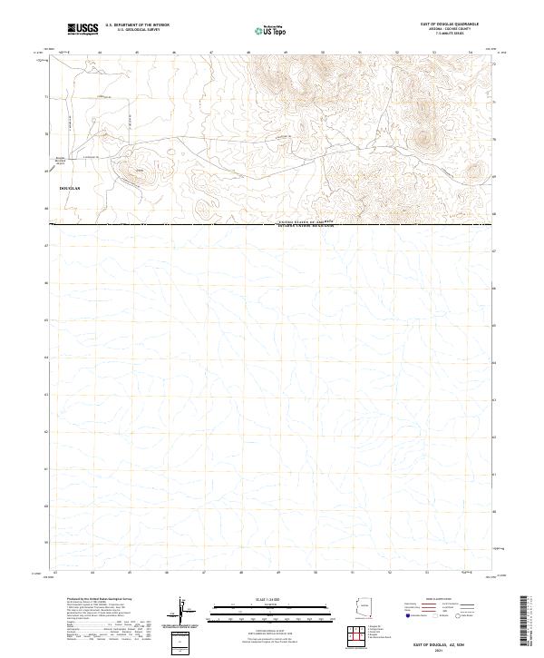
2021 Map of East of Douglas
USGS Topo · Published 2021About this map
Douglas serves as a critical point on the United States and Mexico border in Cochise County, anchoring this desert landscape where the high plains meet the international boundary. The map illustrates the eastern expansion of the city's infrastructure, including the Douglas Municipal Airport and the prominent topographic rise of D Hill. The road network reflects a mix of modern transit and historic passage, with E Geronimo Trl cutting across the terrain toward the mountains to the east.
Find a feature on this map
11 named features on this map. Tap any name to fly to it.
Don’t see what you’re looking for? This feature index may not catch every label — zoom into the map to look around manually.
Map Details
Editions of this 2021 East of Douglas Map
This is the sole edition of this map. No revisions or reprints were ever made.
Other maps of this area

1914 · Douglas
USGS Topo · 1:62,500

1916 · Douglas
USGS Topo · 1:125,000

1919 · Douglas
USGS Topo · 1:125,000

1919 · Perilla
USGS Topo · 1:125,000

1925 · Douglas
USGS Topo · 1:62,500
1933 · Douglas
USGS Topo · 1:62,500

1940 · College Peaks
USGS Topo · 1:62,500

1955 · Douglas
USGS Topo · 1:250,000
1958 · College Peaks
USGS Topo · 1:62,500
1958 · Douglas
USGS Topo · 1:24,000