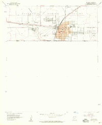
1958 Map of Douglas
USGS Topo · Published 1959About this map
Industrial activity at the Copper Queen Smelter defines the landscape of this international border region in the late 1950s. Located in the Sulphur Spring Valley, the city of Douglas serves as a major port of entry with its Customhouse situated directly on the United States Mexico boundary. The map illustrates the town's growth alongside the Southern Pacific railroad, which links the city to the nearby settlement of Pirtleville and the rail stop at Calumet. Cultural landmarks of the era are clearly visible, including the Drive-in Theater and the local Fairgrounds. Genealogists may find value in the detailed plotting of Calvary Cemetery, Sacred Heart Cem, and a third unnamed Cemetery, while the eastern edge of the quadrangle shows the start of the Geronimo Trail near the Douglas Municipal Airport.
Find a feature on this map
28 named features on this map. Tap any name to fly to it.
Don’t see what you’re looking for? This feature index may not catch every label — zoom into the map to look around manually.
Map Details
Editions of this 1958 Douglas Map
4 editions found
Other maps of this area

1914 · Douglas
USGS Topo · 1:62,500

1916 · Douglas
USGS Topo · 1:125,000

1919 · Douglas
USGS Topo · 1:125,000

1919 · Perilla
USGS Topo · 1:125,000

1925 · Douglas
USGS Topo · 1:62,500
1933 · Douglas
USGS Topo · 1:62,500

1940 · College Peaks
USGS Topo · 1:62,500

1955 · Douglas
USGS Topo · 1:250,000
1957 · Paul Spur
USGS Topo · 1:24,000
1958 · Double Adobe
USGS Topo · 1:24,000