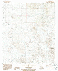
1985 Map of East of Douglas
USGS Topo · Published 1986About this map
The Perilla Mountains and the international boundary between Arizona and Sonora dominate this 1980s landscape. Located just east of the city, the Douglas Municipal Airport sits on the edge of the Sulphur Springs Valley, while the terrain to the east rises sharply into high ridges and peaks. The map documents several small settlements and ranching locations, including El Potrerito, El Alamito, and Gallardo, scattered through the arroyos and foothills.
Find a feature on this map
41 named features on this map. Tap any name to fly to it.
Don’t see what you’re looking for? This feature index may not catch every label — zoom into the map to look around manually.
Map Details
Editions of this 1985 East of Douglas Map
This is the sole edition of this map. No revisions or reprints were ever made.
Other maps of this area

1914 · Douglas
USGS Topo · 1:62,500

1916 · Douglas
USGS Topo · 1:125,000

1919 · Douglas
USGS Topo · 1:125,000

1919 · Perilla
USGS Topo · 1:125,000

1925 · Douglas
USGS Topo · 1:62,500
1933 · Douglas
USGS Topo · 1:62,500

1940 · College Peaks
USGS Topo · 1:62,500

1955 · Douglas
USGS Topo · 1:250,000
1958 · College Peaks
USGS Topo · 1:62,500
1958 · Douglas
USGS Topo · 1:24,000