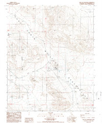
1986 Map of East of Goldstone
USGS Topo · Published 1986About this map
The Fort Irwin Military Reservation occupies this high desert landscape in San Bernardino County, characterized by a complex network of communications infrastructure and mining activity. In the mid-1980s, this area served as a critical hub for radio operations, featuring the Apollo Radio Towers in the west and the Echo Radio Tower toward the center of the sheet. The terrain is marked by various prospects and the AWD Prospect, indicating a history of mineral exploration that predates or coincides with military land use. Notable localized infrastructure includes a Radio Facility, a Substation, and a Sewage Pond, reflecting the self-contained nature of the military installation. The landscape is defined by its administrative boundaries and technical installations rather than civilian settlement, showcasing the specialized development of the Mojave desert for national defense and communications during this era.
Find a feature on this map
18 named features on this map. Tap any name to fly to it.
Don’t see what you’re looking for? This feature index may not catch every label — zoom into the map to look around manually.
Map Details
Editions of this 1986 East of Goldstone Map
2 editions found
Other maps of this area

1933 · Avawatz Mountains
USGS Topo · 1:250,000

1947 · Trona
USGS Topo · 1:250,000

1948 · Trona
USGS Topo · 1:250,000

1948 · Alvord Mountain
USGS Topo · 1:62,500

1948 · Lane Mountain
USGS Topo · 1:62,500

1948 · Goldstone Lake
USGS Topo · 1:62,500

1948 · Tiefort Mountains
USGS Topo · 1:62,500

1951 · Goldstone Lake
USGS Topo · 1:62,500

1951 · Tiefort Mountains
USGS Topo · 1:62,500

1951 · Alvord Mountain
USGS Topo · 1:62,500