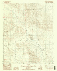
1986 Map of East of Goldstone
USGS Topo · Published 1986About this map
Fort Irwin Military Reservation dominates this Mojave Desert landscape during the mid-1980s, revealing a terrain shaped by defense operations and communication infrastructure. Small named outposts such as Apollo and Echo stand amidst the dry expanse, characterized by specialized installations including a Radio Facility and multiple Radio Towers. The map provides a detailed view of the Military Reservation Boundary as it intersects with local topography, including scattered prospects that suggest historical mining interest in the area. This 1986 provisional edition captures the technical footprint of the facility, mapping the location of a Substation and a Sewage Pond that supported the remote desert infrastructure. The presence of numerous benchmark elevations throughout the ridges and valleys highlights the precision mapping required for this high-desert military training and research environment.
Find a feature on this map
15 named features on this map. Tap any name to fly to it.
Don’t see what you’re looking for? This feature index may not catch every label — zoom into the map to look around manually.
Map Details
Editions of this 1986 East of Goldstone Map
2 editions found
Other maps of this area

1933 · Avawatz Mountains
USGS Topo · 1:250,000

1947 · Trona
USGS Topo · 1:250,000

1948 · Trona
USGS Topo · 1:250,000

1948 · Alvord Mountain
USGS Topo · 1:62,500

1948 · Lane Mountain
USGS Topo · 1:62,500

1948 · Goldstone Lake
USGS Topo · 1:62,500

1948 · Tiefort Mountains
USGS Topo · 1:62,500

1951 · Goldstone Lake
USGS Topo · 1:62,500

1951 · Tiefort Mountains
USGS Topo · 1:62,500

1951 · Alvord Mountain
USGS Topo · 1:62,500