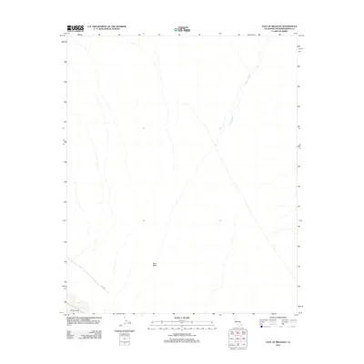
2012 Map of East of Milligan
USGS Topo · Published 2012About this map
Ward Valley dominates this desert landscape in San Bernardino County, showcasing the hydrological patterns of the Mojave. The ephemeral Homer Wash cuts a distinct path through the valley, illustrating how water historically moved through this arid basin toward the southern sink. Near the bottom edge of the sheet, the northern tip of Danby Lake is visible, a dry lake bed or playa that serves as the terminal point for local drainage. A single primary transportation route, Cadiz Rd, provides the only major human infrastructure through the region, connecting this remote stretch of desert with the rail and mining sites further west.
Find a feature on this map
4 named features on this map. Tap any name to fly to it.
Don’t see what you’re looking for? This feature index may not catch every label — zoom into the map to look around manually.
Map Details
Editions of this 2012 East of Milligan Map
This is the sole edition of this map. No revisions or reprints were ever made.
Other maps of this area

1942 · Amboy
USGS Topo · 1:250,000

1943 · Amboy
USGS Topo · 1:250,000
1943 · Turtle Mts.
USGS Topo · 1:62,500
1943 · Iron Mountains
USGS Topo · 1:62,500

1954 · Needles
USGS Topo · 1:250,000
1954 · Turtle Mountains
USGS Topo · 1:62,500
1954 · Rice
USGS Topo · 1:62,500
1956 · Needles
USGS Topo · 1:250,000
1956 · Milligan
USGS Topo · 1:62,500
1956 · Iron Mountains
USGS Topo · 1:62,500