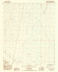
1985 Map of East of Milligan
USGS Topo · Published 1985About this map
Ward Valley dominates the landscape of this 1985 survey, revealing the vast, arid expanse of the eastern Mojave Desert. The map captures the subtle topography of the alluvial plains and the dry bed of Danby Lake in the southwest corner. Transportation and infrastructure are sparse but critical markers of human presence in this region, notably the Atchinson rail line and a prominent Levee near the lake. The alignment of the Trans Line Steel Tower provides a vertical landmark in the flat desert terrain, while the drainage patterns of Homer Wash trace the natural movement of water during rare desert floods. This provisional edition reflects the late twentieth-century state of the California interior, documented through aerial photography and field checks that highlight the intersection of natural basins and industrial utility corridors.
Find a feature on this map
23 named features on this map. Tap any name to fly to it.
Don’t see what you’re looking for? This feature index may not catch every label — zoom into the map to look around manually.
Map Details
Editions of this 1985 East of Milligan Map
This is the sole edition of this map. No revisions or reprints were ever made.
Other maps of this area

1942 · Amboy
USGS Topo · 1:250,000

1943 · Amboy
USGS Topo · 1:250,000

1943 · Turtle Mts.
USGS Topo · 1:62,500

1943 · Iron Mountains
USGS Topo · 1:62,500

1954 · Needles
USGS Topo · 1:250,000

1954 · Turtle Mountains
USGS Topo · 1:62,500

1954 · Rice
USGS Topo · 1:62,500

1956 · Needles
USGS Topo · 1:250,000

1956 · Milligan
USGS Topo · 1:62,500

1956 · Iron Mountains
USGS Topo · 1:62,500