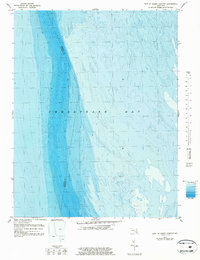
1982 Map of East Of Point Lookout
USGS Topo · Published 1983About this map
Chesapeake Bay dominates this bathymetric study, revealing the complex underwater topography of the Maryland waters. The map focuses on the submerged landscape where the jurisdictional boundary between St Marys Co and Somerset Co runs through the open water. Unlike traditional topographic sheets, this 1982 edition by the National Ocean Survey utilizes tide-coordinated hydrographic data to map depths and shoals. The detail provided captures the shifting nature of the bay floor, showing various depth gradients and the deeper channels that defined maritime transit in the late 20th century. For historians and researchers of the Chesapeake, this sheet serves as a record of the bay's bathymetry before modern coastal changes, documenting the underwater terrain that supported the region’s vital fishing and shipping industries.
Find a feature on this map
2 named features on this map. Tap any name to fly to it.
Don’t see what you’re looking for? This feature index may not catch every label — zoom into the map to look around manually.
Map Details
Editions of this 1982 East Of Point Lookout Map
This is the sole edition of this map. No revisions or reprints were ever made.
Other maps of this area

1894 · Point Lookout
USGS Topo · 1:62,500

1898 · St. Marys
USGS Topo · 1:125,000

1903 · Bloodsworth Island
USGS Topo · 1:62,500

1906 · St. Marys
USGS Topo · 1:125,000

1912 · Point Lookout
USGS Topo · 1:62,500

1917 · Heathsville
USGS Topo · 1:48,000

1917 · Ewell
USGS Topo · 1:62,500

1937 · Point Lookout
USGS Topo · 1:62,500

1942 · Kedges Straits
USGS Topo · 1:24,000

1942 · Ewell
USGS Topo · 1:24,000