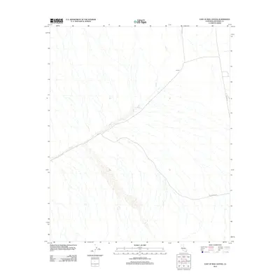
2012 Map of East of Red Canyon
USGS Topo · Published 2012About this map
The desert landscape around Summit in Riverside County is defined by the drainage patterns of Salt Cr, which meanders across the arid terrain. This 2012 survey illustrates the modern path of The Bradshaw Trl and Bradshaw Rd, following a historic transportation corridor across the valley floor. The geography here is sparse, showing a network of ephemeral washes and service routes like Gas Line Rd that intersect near the settlement area. For those studying the evolution of desert routes or tracing 21st-century land use in the Colorado Desert, these layers provide a clear look at how human infrastructure navigates the natural hydrology of the region.
Find a feature on this map
5 named features on this map. Tap any name to fly to it.
Don’t see what you’re looking for? This feature index may not catch every label — zoom into the map to look around manually.
Map Details
Editions of this 2012 East of Red Canyon Map
This is the sole edition of this map. No revisions or reprints were ever made.
Other maps of this area

1940 · Frink
USGS Topo · 1:62,500

1940 · Iris Pass
USGS Topo · 1:62,500

1940 · Canyon Spring
USGS Topo · 1:62,500

1943 · Canyon Spring
USGS Topo · 1:62,500

1944 · Chuckwalla Mountains
USGS Topo · 1:62,500

1944 · Frink
USGS Topo · 1:62,500

1945 · Iris Pass
USGS Topo · 1:62,500

1954 · Salton Sea
USGS Topo · 1:250,000

1955 · Salton Sea
USGS Topo · 1:250,000

1956 · Frink NW
USGS Topo · 1:24,000