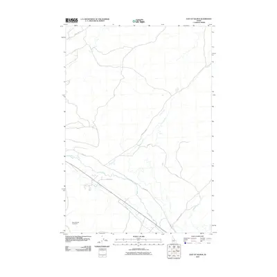
2010 Map of East of Salmon
USGS Topo · Published 2010About this map
The Lemhi River corridor anchors this landscape, flowing through a valley floor shaped by agricultural and irrigation infrastructure. The river and its surrounding roads, including Old Lemhi Rd and 3 Mile Rd, demonstrate the layout of rural Idaho life where water rights and transport routes dictate the placement of homesteads. The terrain is defined by its drainages, with Kirtley Creek and Geertson Creek descending from the higher elevations to meet the valley. The presence of the Warm Springs Creek Dam highlights the essential management of water resources in this arid region. Smaller local thoroughfares like Millers Ln and Youn Rd provide access to private property and agricultural plots, while Carmen Creek Rd and Geertson Creek Rd serve as primary collectors for the scattered residents of the Salmon area.
Find a feature on this map
12 named features on this map. Tap any name to fly to it.
Don’t see what you’re looking for? This feature index may not catch every label — zoom into the map to look around manually.
Map Details
Editions of this 2010 East of Salmon Map
This is the sole edition of this map. No revisions or reprints were ever made.
Other maps of this area

1950 · Salmon
USGS Topo · 1:62,500

1951 · Salmon
USGS Topo · 1:62,500

1955 · Dillon
USGS Topo · 1:250,000

1956 · Goldstone Mtn
USGS Topo · 1:62,500

1957 · Dillon
USGS Topo · 1:250,000

1958 · Dillon
USGS Topo · 1:250,000

1962 · Dillon
USGS Topo · 1:250,000

1965 · Dillon
USGS Topo · 1:250,000

1966 · Badger Spring Gulch
USGS Topo · 1:24,000
1966 · Bird Creek
USGS Topo · 1:24,000