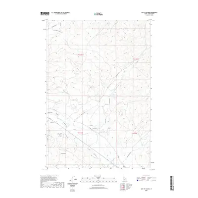
2020 Map of East of Salmon
USGS Topo · Published 2020About this map
The Lemhi River serves as the central artery for this portion of the Lemhi Valley, where the community of Salmon transitions into the foothills of the Lemhi Range. Modern residential expansion is evident through the Black Hawk Subdivision and various rural lanes like Summer Meadow Ln and Country Living Ln. The landscape is a mix of agricultural plots and high-desert terrain, punctuated by small-scale aviation infrastructure such as the 40 Acre Airstrip. Transport patterns follow the natural contours of the valley, with Old Lemhi Rd and Kirtley Creek Rd tracing the drainage paths of Kirtley Cr and Geertson Cr. This survey illustrates the contemporary balance between the established town center and the sprawling reach of ranching and residential properties at the edge of the Idaho wilderness.
Find a feature on this map
36 named features on this map. Tap any name to fly to it.
Don’t see what you’re looking for? This feature index may not catch every label — zoom into the map to look around manually.
Map Details
Editions of this 2020 East of Salmon Map
This is the sole edition of this map. No revisions or reprints were ever made.
Other maps of this area

1950 · Salmon
USGS Topo · 1:62,500

1951 · Salmon
USGS Topo · 1:62,500

1955 · Dillon
USGS Topo · 1:250,000

1956 · Goldstone Mtn
USGS Topo · 1:62,500

1957 · Dillon
USGS Topo · 1:250,000

1958 · Dillon
USGS Topo · 1:250,000

1962 · Dillon
USGS Topo · 1:250,000

1965 · Dillon
USGS Topo · 1:250,000

1966 · Badger Spring Gulch
USGS Topo · 1:24,000
1966 · Bird Creek
USGS Topo · 1:24,000