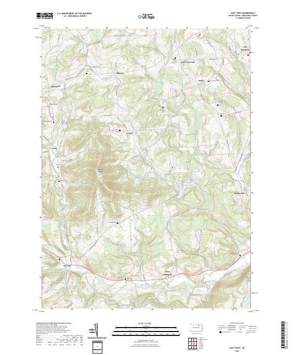
2023 Map of East Troy
USGS Topo · Published 2023About this map
Mount Pisgah dominates the central landscape of this Bradford County quadrangle, where the headwaters of Sugar Creek and Mill Creek carve through the northern Appalachian highlands. The settlement pattern remains largely agricultural and rural, anchored by small communities such as East Troy, Springfield, and East Smithfield. A high density of small family burial grounds, including the William Pierce Family Cem, Utter Edger Family Cem, and Phillips Family Cem, suggests a deeply rooted genealogical history tied to individual farmsteads and early pioneer tracts. Central to the area's modern topography is the significant water body of Stephen Foster Lake, located just north of West Burlington. Transport routes like the Berwick Tpke and Leona Rd connect the scattered hamlets of Wetona, Hoblet, and Leona, following the natural contours of the stream valleys.
Find a feature on this map
83 named features on this map. Tap any name to fly to it.
Don’t see what you’re looking for? This feature index may not catch every label — zoom into the map to look around manually.
Map Details
Editions of this 2023 East Troy Map
This is the sole edition of this map. No revisions or reprints were ever made.
Other maps of this area

1931 · Troy
USGS Topo · 1:48,000

1938 · Troy
USGS Topo · 1:62,500

1939 · Sayre
USGS Topo · 1:62,500

1942 · Sayre
USGS Topo · 1:62,500

1942 · Canton
USGS Topo · 1:62,500

1943 · Powell
USGS Topo · 1:62,500

1944 · Canton
USGS Topo · 1:62,500

1945 · Powell
USGS Topo · 1:62,500

1948 · Sayre
USGS Topo · 1:62,500

1954 · Williamsport
USGS Topo · 1:250,000
Featured Places
- Springfield Township, PA
- West Burlington Township, PA
- Troy Township, PA
- Smithfield Township, PA
- Hoblet, Smithfield Township