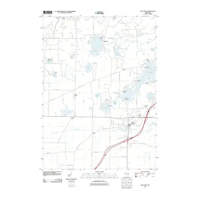
2010 Map of East Troy
USGS Topo · Published 2010About this map
East Troy and its surrounding countryside represent a classic Wisconsin landscape of glacial lakes and dairy land at the start of the 2010s. The village is the primary hub, flanked by smaller communities like Troy Center and Eagleville. The area’s geography is heavily defined by its water bodies, including Lulu Lake, Booth Lake, and Lake Beulah, many of which are controlled by structures such as the Wambold Dam and Lake Beulah Dam. For genealogists and local historians, several burial grounds are scattered across the township, from the Saint Peters Catholic Cemetery near the eastern edge to the Evergreen Cemetery located along the central highway corridor. The Mukwonago River and Honey Creek provide the natural drainage for the region, while landmarks like Army Lake and Camp Edwards indicate the area's long-standing role as a destination for summer camps and recreation.
Find a feature on this map
82 named features on this map. Tap any name to fly to it.
Don’t see what you’re looking for? This feature index may not catch every label — zoom into the map to look around manually.
Map Details
Editions of this 2010 East Troy Map
This is the sole edition of this map. No revisions or reprints were ever made.
Other maps of this area

1892 · Whitewater
USGS Topo · 1:62,500

1892 · Eagle
USGS Topo · 1:62,500

1893 · Delavan
USGS Topo · 1:62,500

1893 · Whitewater
USGS Topo · 1:62,500

1893 · Geneva
USGS Topo · 1:62,500

1894 · Eagle
USGS Topo · 1:62,500

1897 · Eagle
USGS Topo · 1:62,500

1903 · Whitewater
USGS Topo · 1:62,500

1904 · Lake Geneva
USGS Topo · 1:62,500

1906 · Eagle
USGS Topo · 1:62,500