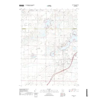
2018 Map of East Troy
USGS Topo · Published 2018About this map
Lake Beulah and Eagle Spring Lake anchor the glacial landscape of this region on the border of Waukesha and Walworth counties. The settlement of East Troy serves as a local hub, supported by the East Troy Municipal Airport and a network of arterial roads like Elkhorn Rd. Smaller communities such as Eagle, Eagleville, and Troy Center are connected by numerous rural lanes, illustrating a land-use pattern that balances lakeside residential developments with open agricultural and wetland spaces. Genealogists will find a significant density of burial grounds including Oak Knoll Cem, Oak Ridge Cem, and Evergreen Cem. The hydrography is particularly complex, featuring the Mukwonago River and distinct shoreline features like Beulah Island and Wilmers Point, while Honey Creek meanders through the southern lowlands.
Find a feature on this map
131 named features on this map. Tap any name to fly to it.
Don’t see what you’re looking for? This feature index may not catch every label — zoom into the map to look around manually.
Map Details
Editions of this 2018 East Troy Map
This is the sole edition of this map. No revisions or reprints were ever made.
Other maps of this area

1892 · Whitewater
USGS Topo · 1:62,500

1892 · Eagle
USGS Topo · 1:62,500

1893 · Delavan
USGS Topo · 1:62,500

1893 · Whitewater
USGS Topo · 1:62,500

1893 · Geneva
USGS Topo · 1:62,500

1894 · Eagle
USGS Topo · 1:62,500

1897 · Eagle
USGS Topo · 1:62,500

1903 · Whitewater
USGS Topo · 1:62,500

1904 · Lake Geneva
USGS Topo · 1:62,500

1906 · Eagle
USGS Topo · 1:62,500